


Fully Waymarked Route
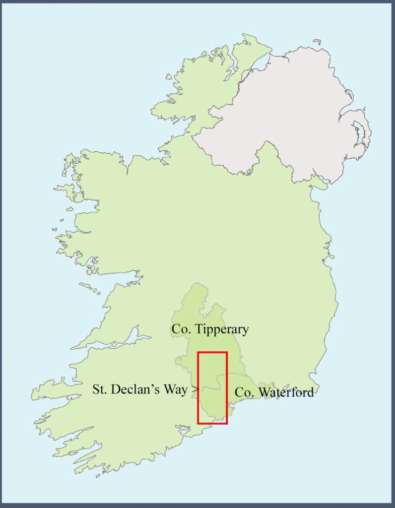
The entire route of St. Declan’s Way, through South Tipperary and West Waterford, is now fully waymarked. It can be freely walked by anybody who wishes. Just follow the blue St. Declan’s Way arrows (with added SDW Duibhín Deaglán Navigation arrows). It passes through Cashel, Cahir, Ardfinnan & passes close to Goatenbridge in South Tipperary. Over the Knockmealdown Mountains it passes through Mount Melleray Abbey, Lismore, Cappoquin, goes close to Aglish and finishes in Ardmore in West Waterford.
Stages
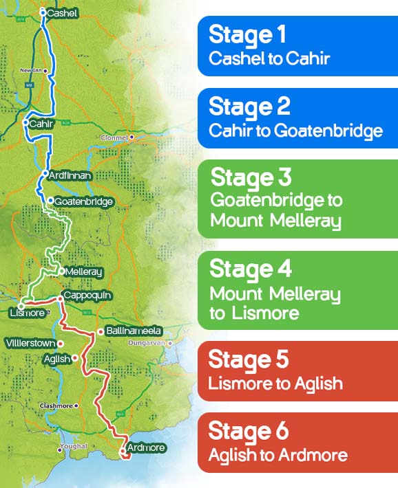
There are no official stages on the route, but walking from Cashel to Ardmore, St. Declan’s Way breaks naturally into six approximately 20km stage lengths which are:
Cashel to Cahir – 23km approx. – Gentle back roads, minor ascents.
Cahir to Goatenbridge – 18km approx. – Flat roads, tracks & trails.
Goatenbridge to Mount Melleray – 18km approx. – Mountain tracks, forest trails.
(Passes across the Knockmealdown Mountains, Requires good fitness.)
Mount Melleray to Lismore – 20km approx. – Downhill forest trails & backroads.
Lismore to Aglish – 21km approx. – Undulating roads, minor ascents.
Aglish to Ardmore – 21km approx. – Rolling back roads, finishing along the beach.
It is possible to walk the route in either direction. Walking north to south (Cashel to Ardmore) just gives a more natural flow and you will ultimately complete the route at the seat of St. Declan, along the beach in Ardmore, which is a fantastic finish point.
History
St. Declan’s Way is a modern route which follows a number of ancient pilgrim pathways including St. Declan’s Road, Casán na Naomh (path of the saints), Bóthar na Naomh (road of the saints) and the Rian Bó Phadraig (track of St. Patrick’s cow). The route was first described in detail by Canon Patrick Power in 1905. Ardmore Enterprise Co-operative produced a wonderful map brochure in 1994 which is still in circulation. The brochure lists 64 sites of historic, natural and archaeological significance along St. Declan’s Way. The route shown was also described by Siobhan Lincoln of Ardmore in her book ‘Along St. Declan’s Way.’
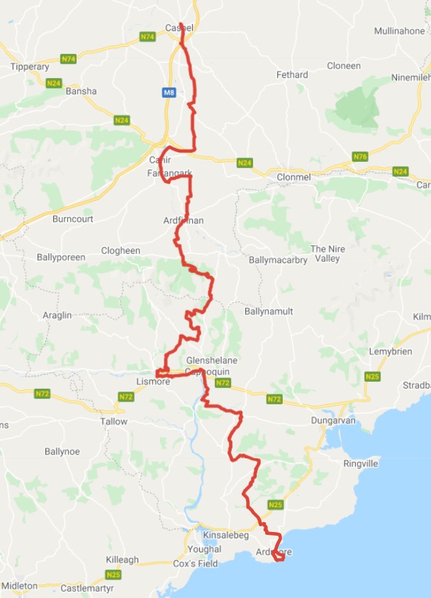
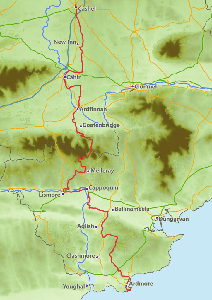
Some changes have been made to these earlier routes for safety and environmental reasons. The route which has been waymarked and signposted starts in Cashel, passes through Cahir and Ardfinnan and over the Knockmealdown Mountains to Mount Melleray Abbey. It then heads into Lismore and follows the Blackwater to Cappoquin. From here it proceeds east along Bóthar na Naomh and swings south at Knocknaskagh towards the final destination, Ardmore.
Maps

Sport Ireland (Click link for Sport Ireland map) sanctioned the St. Declan’s Way Route in July 2021 (scan QR code on the right for SDW page and interactive map).
Printed and PDF map brochures have been completed, click the link. These are also available at a range of venues along the route including, but not limited to, Cashel Tourist Office, Cahir House Hotel & Lismore Heritage Centre.
You can find a zipped GPX file version of the route here. Download to your PC or device, unzip the file and import the resultant GPX file to devices with mapping/navigation software.
Click on the map graphic below for the St. Declan’s Way route on Google Maps which can be used on phones and other mobile devices:
Click on the link below for a PDF overview map of the St. Declan’s Way route:
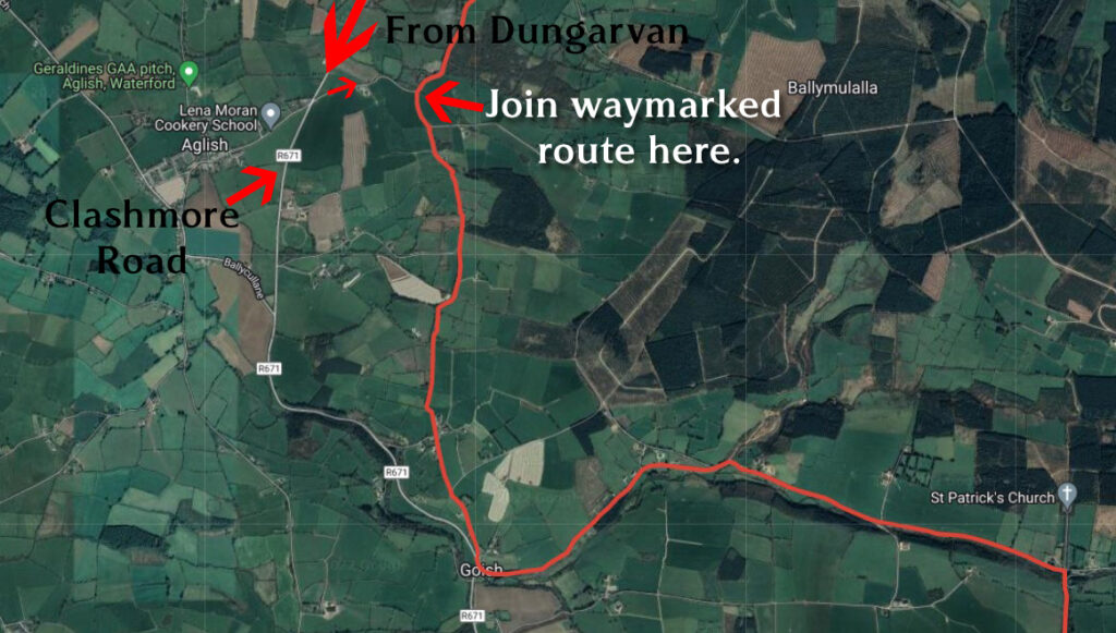
Note: The route DOES NOT pass through Aglish village.
If you are looking to start the Aglish to Ardmore section of the walk, it begins at the top of the lane across the Clashmore Road (R671) having left Aglish village. See map section below:
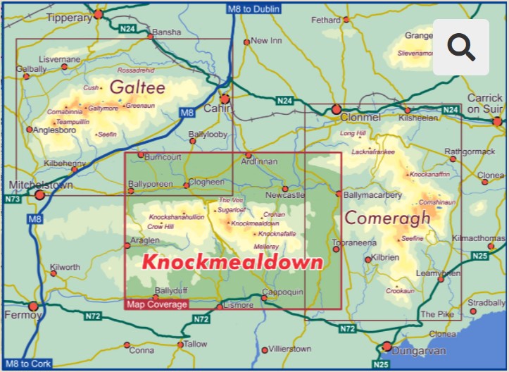
The Mountain Section
If you would like more cartographic information on the mountain section of the route and its surrounds, very detailed maps (1:25,000) of the Knockmealdown Mountains are available from East West mapping (https://eastwestmapping.ie)
The company also provides a phone app (‘EastWest Maps’ on the Play Store on Android or AppyStore on iPhones) to use the digitised versions.
Cycling St. Declan’s Way
Please refer to our post on cycling the route.